The Toughest Thirteen
13 extremely challenging swims for the advanced solo marathon swimmer. If the Oceans Seven are the “Everests” of open water, the Toughest Thirteen are the K2s.
The Toughest Thirteen (an MSF project) aims to inspire marathon swimmers to seek lesser-known, less frequently swum waters offering unique and extraordinary challenges. In 2019, over 200 swimmers have completed the Triple Crown, and many of the Oceans Seven swims have multi-year waiting lists. In contrast, for any of the T13 swims you may not have to wait longer than the next available good weather; and if you’re successful, you’ll be one of only a small handful.
Many of these swims have been DNF’d more often than finished!
View Leaderboard
T13 Criteria
- Repeatable route defined by natural geographical features.
- Not unprecedented, but less frequently swum than any of the O7.
- Significant history of failed swim attempts.
- Geographical diversity: North America (4), British Isles (3), Australia & New Zealand (2), Europe (1), Pacific (1), Latin America (1), Africa (1).
- Route-type diversity: channel crossing (7), bay crossing (2), lake crossing (2), island loop (1), river (1).
- Distance diversity: from 16 to 48 kilometers (10 to 30 miles).
- ʻAlenuihāhā Channel (Hawaii)
- Beltquerung (Germany/Denmark)
- Dál Riata Channel (Ireland/Scotland)
- Derwent River (Tasmania)
- False Bay (South Africa)
- Fastnet Rock (Ireland)
- Foveaux Strait (New Zealand)
- Gulf of the Farallones (Calif., USA)
- Loch Ness (Scotland)
- Monterey Bay (Calif., USA)
- Round-Trip Angel Island (Calif., USA)
- Strait of Juan de Fuca (Wash., USA / B.C., Canada)
- Lago Titicaca (Bolivia / Peru)
ʻAlenuihāhā Channel
A minimum 48 km channel swim between the islands of Hawaii and Maui. Challenges include strong winds, large swells, variable currents, and wildlife. Monitored by the Hawaii Channel Swimming Association.
Four successful swims since 1970:
- Harry Huffaker (1970)
- Penny Palfrey (2009)
- Linda Kaiser (2009)
- Mike Spalding (2011)
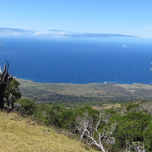
ʻAlenuihāhā Channel (source)
Fehmarnbelt
A minimum 19 km channel swim across the Fehmarn Belt in the Baltic Sea, between the islands of Fehmarn, Germany, and Lolland, Denmark. Challenges include cold water, unstable weather, and cross-currents. Monitored by Beltquerung.
Thirty-six successful swims since 1939.
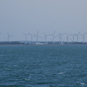
Beltquerung (source)
Dál Riata Channel
A minimum 21 km channel swim between Scotland and Northern Ireland. An alternate, more northerly route of the North Channel, shorter but arguably more challenging due to colder water and stronger currents. Monitored by the Irish Long Distance Swimming Association.
First attempted by Mercedes Gleitze in 1928. Two successful swims since 2012:
- Wayne Soutter (2012)
- Sabrina Wiedmer (2016)
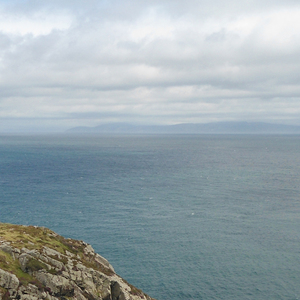
Dál Riata Channel (source)
Derwent River
A 34 km swim in the Derwent River, Tasmania from the New Norfolk Bridge to the Tasman Bridge. Challenges include cold water and unstable weather. Monitored by Chris Guesdon.
First attempted by Chris Guesdon in 1973 as the “Derwent River Big Swim.” Six successful swims since 1975.
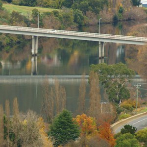
Derwent River (source)
False Bay
A 33-37 km crossing of the width of False Bay, South Africa, between Cape Point and Cape Hangklip. Challenges include unstable weather and white sharks. Sanctioned by the False Bay Swimming Association
Five successful swims since 1989:
- Annemie Landmeters (1989)
- Steven Klugman (2004)
- Carina Bruwer (2006)
- Barend Nortje (2007)
- Ned Denison (2012)
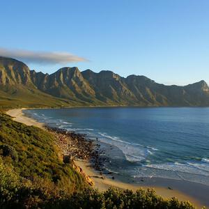
False Bay (source)
Fastnet Rock
An 16-21 km channel swim between Fastnet Rock and mainland Ireland (county Cork). Alternate routes include a 42 km loop around Fastnet, starting and finishing on the mainland. Challenges include cold water, unstable weather, and jellies. Monitored by Fastnet Swim.
10 successful swims since 2011.
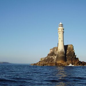
Fastnet Rock (source)
Foveaux Strait
A minimum 29 km channel swim between the South Island and Stewart Island (Rakiura) in New Zealand. Challenges include cold water, unstable weather, and strong cross-currents.
Eight successful swims since 1963:
- John van Leeuwen (1963)
- Meda McKenzie (1979)
- Belinda Shields (1984)
- Michael Quinlivan (1985)
- Sandra Blewett (1988)
- Todd Utteridge (1989)
- Chloe Harris (2016)
- Simon Olliver (2017)
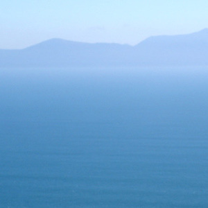
Foveaux Strait (source)
Gulf of the Farallones
A channel swim between the Farallon Islands and the California mainland. Of the five successful solo swims since 1967, two finished on the Marin County coast (33-41 km), and three finished at the Golden Gate Bridge (48 km). Challenges include cold water, strong tides, unstable weather, and white sharks.
- Stewart Evans (1967)
- Ted Erikson (1967)
- Craig Lenning (2014)
- Joseph Locke (2014)
- Kimberley Chambers (2015)
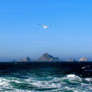
Gulf of the Farallones (source)
Loch Ness
A 36 km lengthwise crossing of Loch Ness, Scotland, between Fort Augustus and Loch End. Challenges include cold water and unstable weather. Monitored by the British Long Distance Swimming Association.
Twenty-four successful swims since 1966, including a two-way crossing by David Morgan.
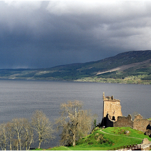
Loch Ness (source)
Monterey Bay
A 37-40 km crossing of the width of Monterey Bay, between its two major cities, Santa Cruz and Monterey. Challenges include cold water, wind, waves, and wildlife (stinging and toothy). Sanctioned by the Monterey Bay Swimming Association.
Five successful swims since 1980:
- Cindy Cleveland (1980)
- Patti Bauernfeind (2014)
- Kimberly Rutherford (2014)
- Amy Appelhans Gubser (2017)
- John Zemaitis (2019)
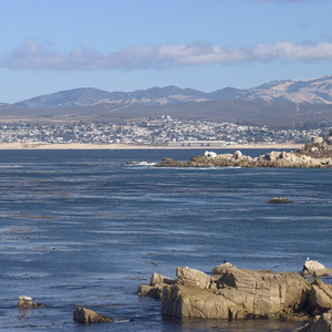
Monterey Bay (source)
Round-Trip Angel Island
A minimum 16 km loop around Angel Island from Aquatic Park, in San Francisco Bay. Challeges include strong cross-currents, cold water, wind, and heavy marine traffic.
27 successful swims since 1984:
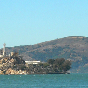
Round-Trip Angel Island (source)
Strait of Juan de Fuca
A 16-30 km channel swim between Washington state (USA) and British Columbia (Canada). Challenges include cold water, strong cross-currents, and unstable weather. Sanctioned by the Northwest Open Water Swimming Association.
Eight successful swims since 1955:
- Bert Thomas (1955)
- Cliff Lumsdon (1956)
- Amy Hiland (1956)
- Ben Laughren (1956)
- Marilyn Bell (1956)
- Vicki Keith (1989)
- Andrew Malinak (2015)
- Melissa Blaustein (2017)
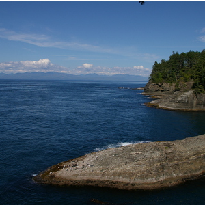
Strait of Juan de Fuca (source)
Lago Titicaca
A minimum 15 km route in Lago Titicaca (Bolivia and Peru). Challenges include high altitude (3812m / 12,500 ft) and cold water.
Note: A canonical marathon swim route in Lago Titicaca has not yet been established. The only known Titicaca marathon swim was completed by Lynne Cox in 1991 - a coastal 15km route between Copacabana, Bolivia and Chimbo, Peru. To qualify for the T13, swimmers must complete a route of at least 15km. If a longer, cross-lake route is pioneered in the future, we may revise/raise the minimum standard for a T13-qualifying Titicaca swim.
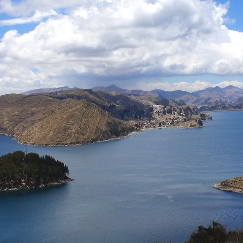
Lago Titicaca (source)


