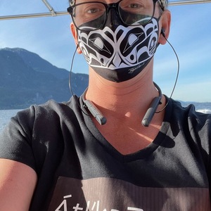
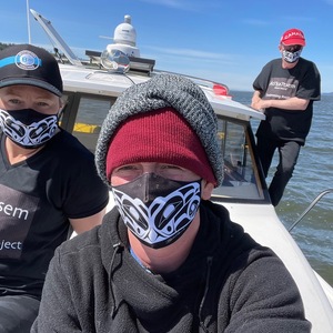
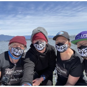
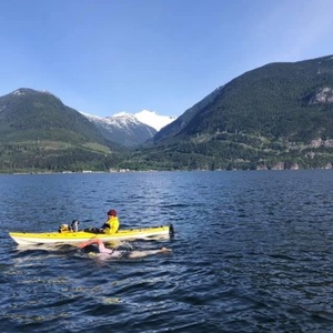
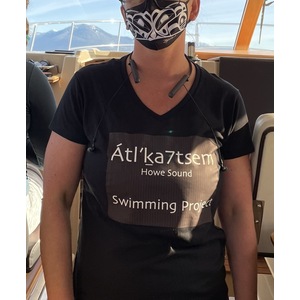
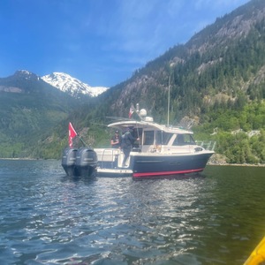
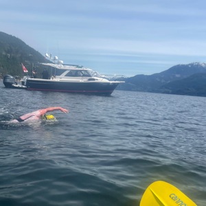
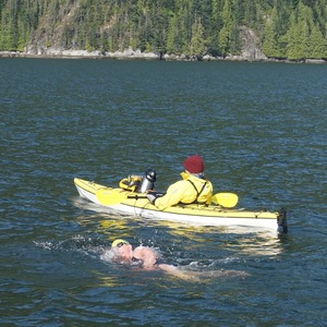
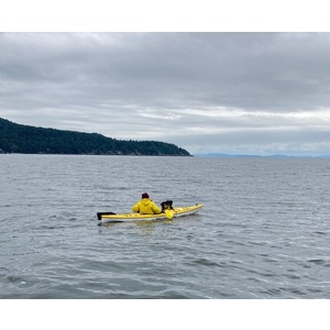
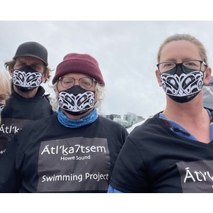
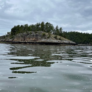
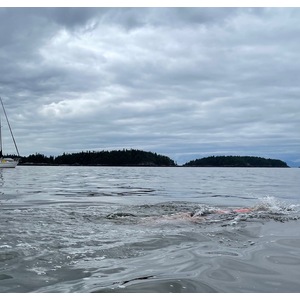
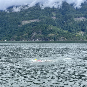
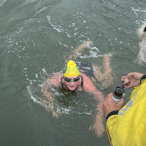
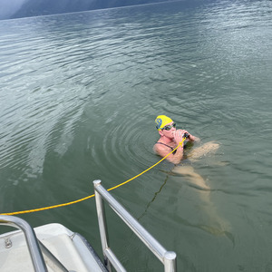
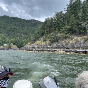
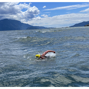
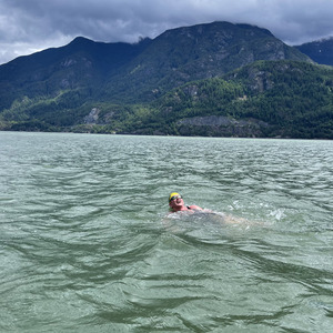
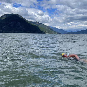
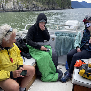
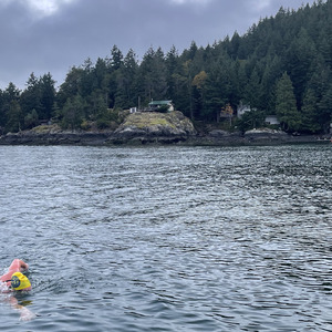
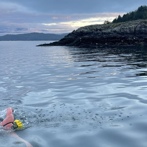
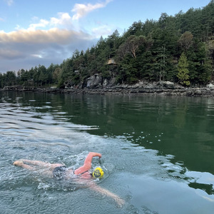
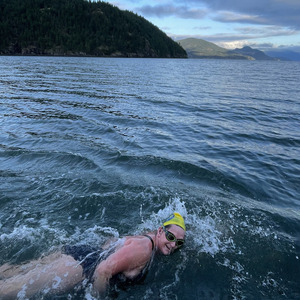
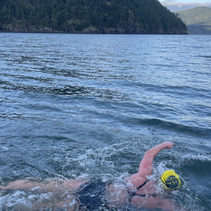
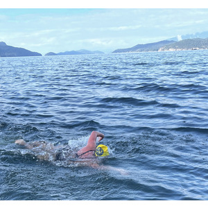
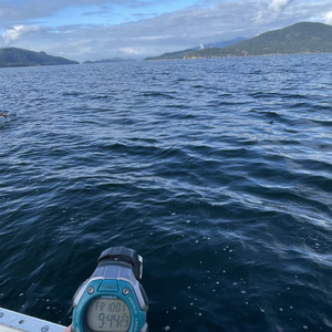
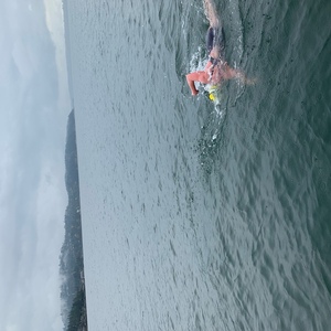
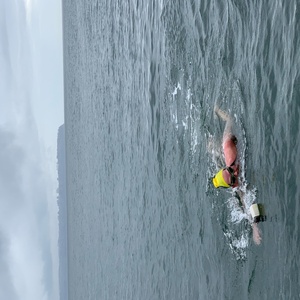
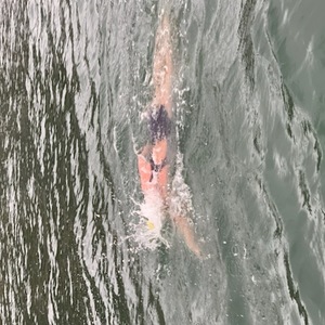
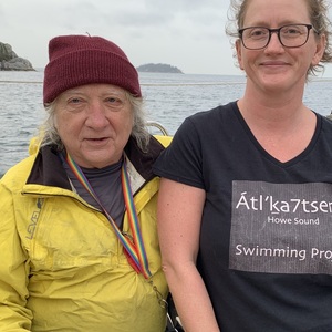
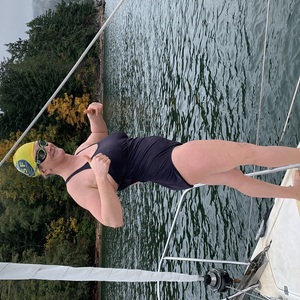
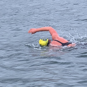
Jessi Harewicz - Átl’ka7tsem Howe Sound Swimming Project

Átl’ḵa7tsem meaning “Paddling North” or Txwnéwu7ts meaning “Paddling South” in Squamish language, is located NorthWest of Vancouver BC.
The Átl’ka7tsem Howe Sound Swimming Project was inspired by my curiosity to navigate the water where the Sḵwx̱wú7mesh Úxwumixw (Squamish Nation) have there lived for thousands of years. Howe Sound was the name Captain Vancouver gave this fiord in 1792 after British Admiral Richard Howe. As of September 2021 - it was named a Unesco protected area.
I have attached some First Nations names and stories. As Sḵwx̱wú7mesh Úxwumixw have been the protectors of these waters for Thousands of years. I also helped to promote awareness with the https://mlssbc.com/ & the Howe Sound/Atl'ka7tsem Marine Reference Guide https://howesoundguide.ca/
Swimmer
- Name: Jessi Harewicz
- Gender: female
- Age on swim date: 38
- Nationality: Canada
- Resides: Vancouver, British Columbia
Defence
Inspiration
Start of swim: Xwelxwalitn place of the white people (Watt Point).
Land area jutting into a water feature. Home to Watt Volcanic Center: is a small outcrop of Pleistocene age volcanic rock.
This was the location of the first contact between the Squamish Nation and Captain George Vancouver. A Squamish Elder sighted what appeared to be a large floating island offshore. The warriors approached with canoes in attack formation prepared for battle or trade. The found a large canoe with a dead tree on it manned by stéwakin - people so pale they appeared dead. Upon boarding, the warriors were greeted with a handshake which was a gesture of challenge known as keléxw to the Squamish. A Chiyák'mesh warrior realized that the foreigners were actually living beings when his opponent cried out in pain upon having his finger dislocated. (December 2011 from: Cultural Journey Sea-to-Sky Corridor website, Squamish and Lil’wat First Nations)
Finish of swim: Kwem Kwem (Defence Island 28)
Kwum Kwum: meaning ‘bull kelp’ was often used by Squamish warriors as a place from which to intercept Northern Invaders.
Ancient Burial grounds First Nations Reserve. No Public Access
Planning
Don Martin Planned this swim for weather & tides.
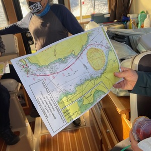
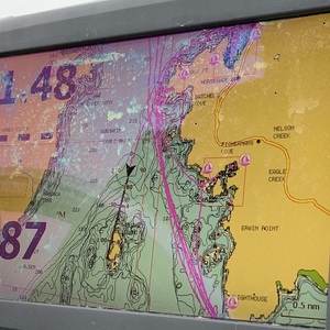
Route description: Starting at Watts Point Swimming South West down Montague Channel As we approach Kwem Kwem smaller island, passing south of the island towards Thornbrough Channel to the Western tip of Kwem Kwem larger island. Looping around the West Side of both islands to finish at the eastern tip of small Kwem Kwem
This swim was greatly influenced by the River from the Squamish River. The flow gauge at Brackendale was at around 50 cu M / sec from Feb to mid April. It is now running at 250 cu M / sec. That is a huge change. The current flow is well above the upper quartile of the normal flow rate for this time of year. Unless things change substantially before May 11 we will have great current all the way from Watts Point to Defence Islands (just over 8 km). Here is the data if you are interested in the nitty gritty.
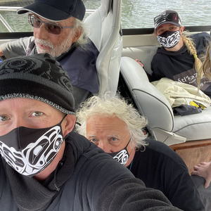
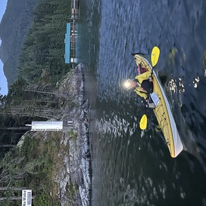
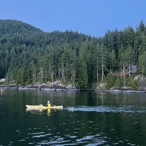
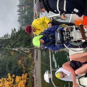
Support Team: Don Martin (captain), Stewart Scott (observer), Richard Harewicz (kayak), Kelcy Ogilvie (swim support).
Route
From Watt Point, southeast to Defence Islands, clockwise loop around islands until close loop. 11.1 km
Result
- Start: 2023-05-11 08:32
- Finish: 2023-05-11 11:22
- Elapsed: 2:48:55
GPS Map
Observer Log
Observer Report
by Stewart Scott
On Tuesday 11 May, 2021 we took to the calm waters of Howe Sound to observe Jessi Harewicz complete the first known crossing from Watts Point to Defence Island via Kwum Kwum.
We met Captain Don Martin, boarded ‘Anywhere’ and set off from Jericho Pier at 7:00 am for the one-hour sailing up to Watts Point. Also aboard were Richard Harewicz aka ‘Kayak Dad’ providing kayak support, and Dr Kelly Ogilvie who would swim part of the route with Jessi and provide emergency safety support if required.
An orca sighting en route to Watts Point got the day off to an excellent start and fuelled excitement for the swim to begin.
Arriving at Watts Point around 8:00 am we held our final safety briefing, scouted the best entrance point and Jessi got the swim underway at 8:32 am diving into calm waters with a light 6 knot NE wind kicking up some small chop. A favourable current help Jessi cross Howe Sound averaging 5km per hour and then we turned South to follow the coastline.
Kelly got into the water at this point and accompanied Jessi for approximately 4km down the coastline toward Defence Island. As she exited the water all that was left for Jessi was to round Defence Island, cross and round Kwum Kwum and then complete the circuit swimming back over to Defence Island. This was a beautiful stretch as we were close to shore and had the rambunctious support of local geese and a few seals.
Captain Don did a remarkable job reading the water conditions, making ever so slight course adjustments to keep Jessi in favourable current and allowing the swim to pass with the minimum of fuss. Jessi kept a strong consistent stroke at 66 strokes per minute throughout the whole swim.
At 11:22 am Jessi completed her circuit around the Island and then landed ashore to finish the swim all the while making it looks like an easy stroll in the park. The water temperature ranged from 10-12 degrees for the majority of the swim, with one ‘HOT TUB’ section reaching a balmy 13 degrees for a brief moment.
Swimmer Narrative
by Jessi Harewicz
Prep
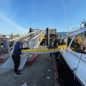
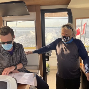
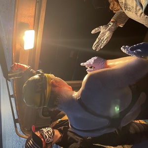
We loaded on time at 6:45am at Jericho Public Pier. I forgot a part of the GoPro camera. So Richard drove back quickly while Kelly & Stewart loaded the boat. We were all loaded and heading toward Watt Point. Stewart read the preswim briefing with Don going over the route, as we boated.
We got treated to Orca’s around 7:45am about 500m ahead of us, just past Anvil Island. I knew they were in Átl’ka7Tsem. They were truly, ‘going up the river’.
We got everything ready. My crew kept ‘reminding me to eat’. So Awesome. I always forget while getting everything ready. I thought the SPOT tracker was working (i was wrong). But I knew Don had a backup track on the boat. I decided last minute to put on destine. My back has been getting burnt while training. So I decided to train Kelly ‘to paint’ me. We got the kayak with fresh hot water in the water. I got my final pictures.
Swim
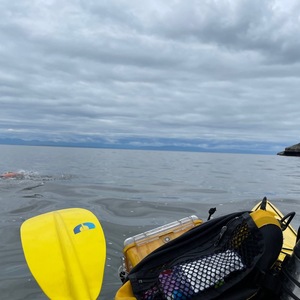
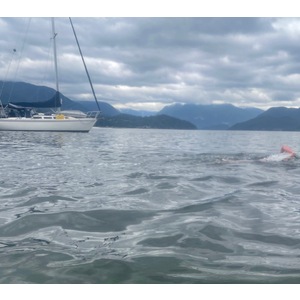
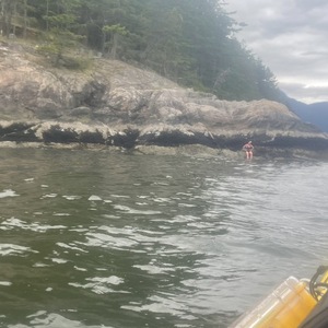
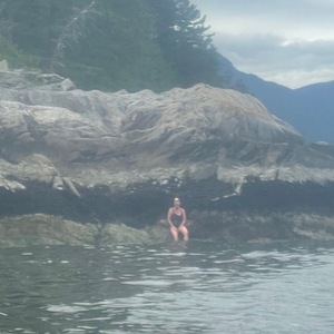
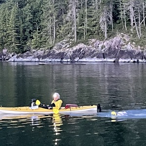
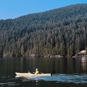
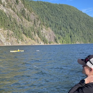
I decided to dive in. The water felt nice. The warm sun on my back. It was so pretty. I got on a rock. I tried to find a rocky surface to not hurt any habitats near the water’s edge. I looked around. Gave thanks to the great spirits & mother nature for allowing Atl’ka7tsem to thrive again in all its beautiful glory. I am but a visitor, who has trains hard to be in my bare skin. Traveling Átl’ka7tsem (up the river) and Txwnéwu7ts (down the river). But still a Visitor.
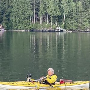
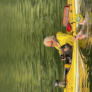
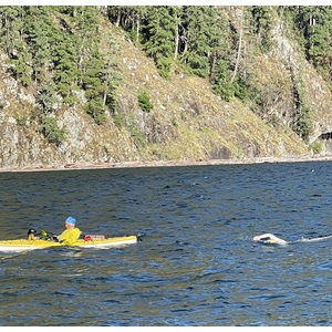
I swam to the Kayak. We started. I could see a Glacier. It was so pretty. I tried to focus on whatever was in my sight line while breathing side to side. I feel like nature listens. Atl’ka7tsem has been designed so precisely. There is always something to look at. The water felt cool. First feed went good. My ‘helper’ made my bread bites a bit too big. But I adapted. Almost no wind. Dad was paddling and gliding. I finally asked how we were doing for pace. He said we were flying !
I saw a swimmer in the water. I got confused. Thinking it was someone else swimming who swam from shore. Dad was like “that’s Kelly’… oh right. I wasn’t even tired or cold. But confused like ‘normal’. Kelly kept pretty far back. I could already see Kwum Kwum !
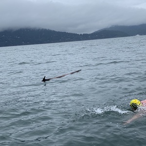
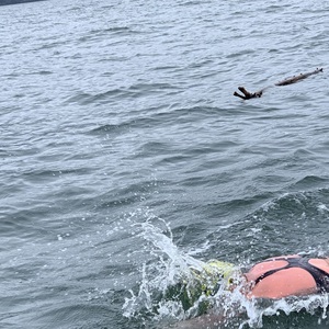
We started angling across the channel, the opposite direction of the island. I remembered the map. I knew there was a reason to do this. It helped carry us down towards Kwum Kwum. I saw a bight piece of driftwood on Defence 28 (smaller island) this is where I knew we would go right or left. I had forgot. We went left. As we started counter clockwise around the island I saw another Glacier. As we got past Defence 28 to Kwum Kwum. I also noticed the water getting warmer. HOT TUB. I screamed… apparently that was the warmest spot. I regained any loss I had in the fingers. I asked my dad is I could swim closer to the island. So we swapped spots. So I swam to the left of him for most of Kwum Kwum. As we passed the western tip of Kwum Kwum he went back inside on the right of me. As we finished soon after. I saw the naked (no bark) driftwood. We were done. I floated for a few minutes. Dad’s like ‘swim to your rock, we gotta go ! So I swam into Defence 28 Island. Touched it and swam back.
Quick swim on less than 3 hours. Salish Sea gave us this one today. Probably one the second time I finished early in the 6 years. But we are humble servants whom just want to play in the water. Thanks to all crew and the Salish Sea. Never a dull moment.
Photos
Video
Keats
Planning
Don Martin Planned this swim for weather & tides. See debrief for more details.
I had previously swam around this island (not documented) in 2016 in preparation for my first Georgia Straits crossing with only Kayak support from the Sunshine Coast side of Georgia Beach.
- Support Team: Kat Blades (pilot), Richard Harewicz (kayak), Scott Doran (observer).
- Route definition: Clockwise circumnavigation of Keats Island from Cotton Point. 12.9 km
Result
- Start: 2021-05-26 10:11
- Finish: 2021-05-26 15:12
- Elapsed: 5:01
GPS Map
Observer Log
Observer Report
by Scott Doran
The support boat was supplied by Kat Blades of North Vancouver, a 30’ sailboat.
Onboard were 4 souls, the Captain Kat Blades, the observer Scott Doran, the kayak support Richard Harewicz, and the swimmer Jessi Harewicz.
The support boat departed Coal Harbour in Vancouver at 6:00am May 26.
Destination was Keats Island and Cotton Point as a start and finish spot.
The trip was rough and windy.
Arrival to Cotton Point was 9:30am, 30 min early from our estimated start time of 10:00am.
We made ready the kayak and the swimmer for a leisurely entry into the water at 10:00am
The swimmer made to shore for a departure time of 10:11, a clockwise circumnavigation of the island.
The water temp was a warmish 14*c and the start for the swimmer was uneventful, for the support boat we had a toilet overflow but never lost pace with the swimmer.
I was impressed by the kayak support on his control of his boat and the course set.
Notes were taken every 30 min and the stroke pace was noted.
The southern side of the island was calm and no large waves noted unlike our trip over.
At the western tip the swimmer upped her pace to combat tide, once around the western point the tide assisted the swimmer making up for the adverse currents on the east side.
The support boat had to divert its route to avoid shallow water but contact with the swimmer was never lost.
On the last legs the swimmer was asking for remaining distances, more then once.
The expected current on the home leg never appeared and the finish was made 5 hours and 1 min after the start.
The condition of the swimmer was good, she boarded the boat after touching the same location as she started, the tide was lower at the finish.
The kayak was reloaded onto the support boat for the return trip to Vancouver.
All in all a good day, 13C air temperature and overcast the entire time.
Swimmer Narrative
by Jessi Harewicz
We met Kat and Scott at the Vancouver Rowing Club at Coal Harbour at 5:30 AM. As we left the dock at 6 AM. To get the outgoing current underneath the Lions gate Bridge. We got out successfully and arrived near Cotton Point (north west end) at Keats Island just before 9 AM. I called Don to brief everyone on the swim.
9:30am we started getting the kayak in the water. Just after 10 AM I dove off the boat. I swam over to a reddish looking rock. This is where we would be starting. So I got above the waterline. And started swimming just after 10 am.
The East side of the island was pretty good! It was flat water. I swam pretty steady and ploughed through a little bits of sea bush. I got a little piece stuck around the top of my neck. Which eventually I had to set it free. We don’t want sea bush chaffing! As we got closer to the southern tip the wind starting to pick up a little bit. And I could tell that I started fighting a little bit of current. Which was predicted, if we got to the southern tip too early. But I didn’t have to fight it too much and got around the corner and started up north towards Langdale.
I did notice the boat go off though. I knew it was quite shallow water as I could see the bottom. There was seashells scattered and lots and lots of sea bush. I started asking too many questions to my dad. His radio started acting up or something. He kayaked over to the boat. I kept swimming. I had a feeling we were not on schedule to finish in 4:20 hours. So I swam bit harder. I got more & more stressed. The water felt so warm. I was questioning if I should have done this swim earlier in the season. The last 1.5 hours I just focused on swimming. Fighting off the tears of frustration of knowing I wasn’t going to finish in the predicted time. I never seem to get used to the uncertainty of the ocean. It usually takes 2-3 hours until my mind lets go of things. We finished in 5 hours.
After the swim I talked to Don Martin (who planned the route). We swam bit further than predicted & hit a few currents not predicted. So a 2.8km per hour is what was thought to have been my pace for this swim.
Photos
Video
Anvil
Inspiration
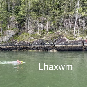
Lhaxwm/Anvil & the serpent legend.
The larger island situated at the mouth of the Montagu Channel towards Squamish. For the Skwxwú7mesh Úxwumixw Lhaxwm/Anvil island was used as a fishing camp. Deer and duck hunting. The island was an important place of spiritual training for the Squamish. According to legend, the spirit of a powerful serpent lives on its peak. Squamish warriors would get dizzy from its power. And mythical monsters known as sasquatches (smaylílh) are said to have walked the pebbly shores of the island, while at its summit lives a giant mythical spirit known as Kwelháynexw ta élhkay. (‘The Squamish Chief, 2016) The island was once a huge serpent (it resembles a coiled up snake) that was turned into the island, which is mostly steep and rocky, by the Xaays, or the Transformer brothers who traversed Squamish territory teaching people the right ways of doing things and they also set the world right. The high interior of the island is also the home a mythical being Ninc’ashen or “One Leg.” He was generally considered harmless and sometimes even aided people during their spiritual fasting and training.
Colonialism
The island was anglicized on June 14, 1792 by Captain George Vancouver, whose journal for the day reads: “The sun shining at this time for a few minutes afforded an island which, from the shape of the mountain that composes it, obtained the name of Anvil island.” In 1847, after sailing through Howe Sound in search of a place to settle, Englishman Thomas Keeling landed on the island. He bought the land from the government and became rich after finding nearly 90 acres of clay that was ideal for making bricks. The island was stolen from the aboriginal people. Apocryphal it may be, the tale illustrates the kind of attitude that was so pervasive among the colonists some 130 years ago. (The Squamish Chief, 2016)
Planning
Don Martin Planned this swim for weather & tides. details.)
The chart attached shows his time predictions. Based on a swim speed of 2.7 km per hour. This swim was strategic planned for 13 days before the Chá7elkwnech/Gambier swim. As I was using these smaller swims as preparation.
The overall plan was to start at the northern Domett Point. Swim south to make the southern tip at low tide at 12:13pm. Use the incoming tide to help us return to the northern finish (start) at Domett point.
Before Swim
It is important to note that we were approach bye city television CTV. To do a video segment before I started to swim. In conjunction with our support for the Marine Life Sanctuaries Society. This is the first time I’ve endorsed a conservation organization.
MLSS discovered the coral sponge reef that lay beneath the surface throughout Atl’ka7tsem.” I get to swim the surface beauty, but we have to preserve what lies beneath.” So I did a quick interview from the cameras on another boat before I started the swim. Thanks again to Glen Denison for setting this up!
We also swam into a long dust paddle boarder who was out for circumnavigation of Lhaxwm/Anvil himself! There is a video he recorded attached. Through the magic of social media, we are now connected!
- Support Team: Frank Parsons (pilot), Richard Harewicz (kayak), Christine Burns (observer), Marlaina Rhymer (support swimmer / social media).
- Route definition: Counter-clockwise circumnavigation of Anvil Island from Domett Point. 13.4 km
Result
- Start: 2021-06-10 09:59:25
- Finish: 2021-06-10 14:54:10
- Elapsed: 4:54:45
GPS Map
Observer Log
Observer Report
by Christine Burns
Jessi, Richard and I met in the parking lot at Jericho Sailing Centre. Frank picked us up at Jericho Pier. We proceeded to Horseshoe Bay to pickup Marlaina. Once Marlaina was on board we proceeded to Anvil Island. I read the pre swim briefing aloud to everyone on the way to the starting point.
We arrived at the starting point (Domett Point) and another boat was there waiting. Jessi did a quick interview and then prepared to enter the water. Jessi entered the water from the right side of the boat @ 9:55 and did a swim from the boat to touch the island to begin her swim. Richard prepared to take a video of the swim start. Jessi touched the island and then started her swim. Swim start @ 9:59:25
Jessi started the swim on the left side of the boat with the boat a fair distance from her on the right. Frank indicated the water was deep enough that we could get closer to land without worry of rocks. Once we got around Domett Point we indicated to Jessi that she should swim on the right side of the boat.
The planned route went quite wide around the island in certain points to avoid currents that would pull us towards the island.
Feed at 10:29 was quick. Richard reminded Jessi to make sure she had an eye on the boat. She was annoyed with her earplugs. Jessi consumed 1 bottle of liquid and 1 jelly roll and resumed swimming.
The weather was constantly changing - sun/clouds, light rain/dry, no wind/wind gusts.
Feed at 10:59 was quick. Richard indicated Jessi needed to pick up the pace just a bit. Jessi reminded us to yell louder as she can’t hear due to earplugs. Jessi consumed 1 bottle of liquid and 1 jelly roll and resumed swimming.
Shortly after the second feed a random dude on a paddleboard showed up “Is that the girl swimming around the islands?!?”. I confirmed it was indeed her and consented to him taking
pics of her. He paddled off far to the right side of her and took some photos/video. He indicated that he had paddled around many of the Howe Sound islands (including Gambier!).
Feed at 11:29 was quick. Jessi asked if we were on time - Richard indicated she was. Jessi consumed 1 bottle of liquid and 1 jelly roll and resumed swimming.
At 11:45 the waves started, the boat started rocking and Frank indicated it was harder to stay with her. The wind had picked up quite a bit. A few minutes later we decided to flag Jessi down and have her move to the left of the boat so we could move farther away from land.
Feed at 11:59 was bouncy. The wind was blowing and there was quite a bit of chop. Jessi consumed 1 bottle of liquid and 1 jelly roll and resumed swimming.
Feed at 12:29 Jessi asked for updates and reminded Richard and Marlaina they should have this info ready for her. Richard indicated that she was on track and to head to lands end peak to avoid currents pulling into the bay. Jessi consumed 1 bottle of liquid and 1 jelly roll and resumed swimming.
Jessi’s pace increased quite a bit during this time the winds current were pushing us North. The winds were pushing us quite a bit ahead so the boat did a circle back to stay with the swimmer.
12:59 Feed delayed 2 minutes due to wind gusts. Richard indicated she was making great time. On track or even a few minutes ahead. Jessi consumed 1 bottle of liquid and 1 jelly roll and resumed swimming.
Jessi was still moving pretty quickly. She experienced one cramp in her left calf but didn’t stop and just kept going.
1:29 Feed was very quick. Jessi asked if we were at 3 or 3.5 hours. I indicated 3.5. Jessi said Ok! Let’s go. Jessi consumed 1 bottle of liquid and 1 jelly roll and resumed swimming.
Marlaina started the process of putting on her wetsuit.
1:59 Feed was very quick. Jessi said she felt like she was falling behind but Richard told her she was right on time. 50 more minutes! Jessi consumed 1 bottle of liquid and 1 jelly roll and resumed swimming.
A couple minutes later Jessi stopped and asked “are we on 4 hours?”Richard said “Yes” and Jessi resumed swimming.
Marlaina entered the water at 2:09pm and swam far to the right and slightly behind Jessi until.
At 2:25 Jessi indicated she needed a minute - she said “I can’t pee”. Less than a minute later she resumed swimming.
At 2:30 she had her last feed. She confirmed that she was able to pee when she stopped a few minutes earlier. Jessi consumed 1 bottle of liquid and 1 jelly roll and resumed swimming.
Jessi swam past the start point at Domett Point. We blew a horn to indicate she could stop. Marlaina swam directly to the boat and boarded the boat using the ladder at the back. Jessi swam to the island and touched land. Swim Finish 2:54:10
Total Duration = 4:54:45
Jessi continued to swim farther around the island until she found a spot she could stand. She stood in the water briefly stretching and then swam to the boat. Jessi boarded the rear of the boat on the ladder (unassisted). Jessi was in great condition and was able to remove her bathing suit and put on her recovery clothing on her own. The boat departed for the return trip.
Marlaina was dropped off at Horseshoe bay and then we proceeded to Vancouver. We docked at the Royal Canadian Yacht club.
Pilot Debrief
Swimmer Narrative
None submitted.
Photos
Video
Gambier
Inspiration
Whale in the door
As told by, Skwxwú7mesh Elder. A Mink, a trickster, and his sister, skunk, and gave a big Potlatch on Gambier island. All the animals from around the area came to his long house. Even the undersea creatures attended, being placed in large cedar bentwood boxes filled with water. In addition to all the other species, Mink invited Whale. After everyone else was already inside, Whale swim fast and launched himself into the land in order to peek his head into the door of the longhouse.
In doing so, his large head blocked the whole entrance and trapped the others inside. This was all part of makes plan to get everyone together & force them to talk to each other.
“Now the whales have returned a Howe Sound after a long absence”. Lewis added. “They are doing the same thing, they have all trapped us in one room and we are talking to one another.” (Whale in the door, Pauline Le Bel)
Planning
Don Martin Planned this swim for weather & tides. He picked this day based on the big tidal range. All the other swims (other islands) were to build up to this day. With pool restrictions due to COVID, I could not get more than 1:15 hour pool sessions) We had arranged to hire a boat from Bob Michael. He had moorage at West Vancouver Yaht Club (WVYC) Our start time was to be 4:30am at Elkins point which was few hours boat from WVYC. Bob was not able to operate his boat at night.
3:00 am We would arrange for a water taxi to pick up swimmer & crew with gear from Ch’axay/Horseshoe Bay. At 3:30am load water taxi. Get ready for swim, on the water taxi.
4:30 am we would start the swim with the water taxi at Elkin Point with my dad kayaking with the swimmer (me). The kayak has cel phone & food & hot water thermos. Self sufficient for 4 hours. Gear & Crew would transfer from water taxi to Bob’s boat at estimated meeting point 30 minutes after sunrise. Bob would be staying overnight on Chá7elkwnech/Gambier Alexandra Island RYVC outstation. He would leave Alexander island at sunrise. And boat around Chá7elkwnech/Gambier to meet us near Brigade Bay (on east side of Chá7elkwnech/Gambier. It was almost straight across from Pam Rocks ( just south of Lhaxwm/Anvil). At this time, my crew would transfer over to Bob’s boat. Including my bags & my dads bags. And hopefully return to me, the swimmer & kayaker, as quickly as possible!
To make this transition easier. We would meet up with Bob the night before June 22nd, 2021 & load up his boat at WVYC with food & gear that would would need after the first few hours!
Route Plan
- 14 feet of tide for the day
- Start at Elkins pt. 4:30AM
- We can start at Elkins when the outgoing current.
- Elkins to Halkett 8:00AM
- Push from Squamish river down to Halkett & Hope Point and across the bottom.
- Hallkett to Hope 9:30AM
- Hope to Grace 11:40AM
- The bottom section (Hope to Grace) - no particular current. And turn inside Grace. Which is ruff spot. Hope Point to Grace will be boring, and a bit bumpy. Re charted to go inside grace islands. The Currents are unpredictable in that area. Potentially nasty spot. Clearance no problem for boat.
- Grace to finish minus 4km 15:10PM
- Spot picked because of current changed. More current assist than the last part
- Last 4 Km to Finish @ Elkins 16:35PM
- Less current assist on this part.
- Support Team: Gavin (pilot), Bob Michael (pilot), Richard Harewicz (kayak), Christine Burns (observer), Matt Elcock (support swimmer / social media), Teresa Seibel (observer 2 / kayak 2).
- Route definition: Clockwise circumnavigation of Gambier Island from Ekins Point. 36.4 km
Result
- Start: 2021-06-23 04:31:17
- Finish: 2021-06-23 21:51:42
- Elapsed: 17:21:25
GPS Map
Observer Log
Observer Report
by Christine Burns
Swim Description: Non-Stop, Unassisted, Clockwise Circumnavigation of Gambier Island. Equipment: one swimsuit, one cap, one pair of goggles, one pair of earplugs, lots of desitin Observer Report
06/21/2021
Team has a pre swim meeting on Zoom for team introductions and swim plan discussion.
Jessi reads the safety briefing and we all introduce ourselves before reviewing the swim plan and route navigation. Don Martin joined the zoom meeting to discuss the route and some possible areas where we may need to deviate based on conditions.
06/23/2021
03:15 - The crew minus Bob met in horseshoe bay at the public dock at. Everyone was tired but full of excited energy and ready for the day.
03:30 - The crew boards the water taxi (Mercury 9). It’s still dark out but we could just see an edge of light coming over the mountains. The sun rose as we rode out to the swim start.
04:20 - We arrived at Elkins point - the crew celebrated the lighthouse on the point - as it will make an excellent swim start/finish - great for photos. Richard and Matt get the Kayak in the water. Teresa helped Jessi with final preparations (desitin, ear plugs)
04:30 - Jessi entered the water from the rear of the water taxi and swam the short distance over to the lighthouse. Jessi was able to stand on the rocks at the point. She stood with one arm above her head waiting for the whistle. RH got into position with the Kayak
04:31:17 - Horn was blown and Jessi started her swim. Photos and video recorded. Coordinates recorded.
Swim start was very calm, it was a beautiful morning. The water was calm and warmer than the air temp. Crew notes that the water is warmer than Jessi was expecting.
05:01 - First feed was quick and easy - 1 liquid and 1 jelly roll. Jessi gave the crew a thumbs up.
The crew noted that there was a lot of debris in the water. There was a lot of debris, mostly logs and cut trees, throughout the whole swim.
05:10 - the crew notes that no one has any cell reception. Gavin (water taxi pilot) indicates this is a dead zone and we will have no coverage for at least a mile.
05:20 - another boat appears to be headed towards us - we determined this was Bob and Teresa and Matt gathered our things in preparation for boat transfer.
05:25 - crew transfers to the other boat “New Day”. RH continues to Kayak with the swimmer and I (Christine) was able to maintain line of sight with the swimmer throughout the transfer process.
05:31 - Feed 1 liquid and 1 jelly roll. The feed bottle was dropped and the boat did a u-turn to retrieve it.
The crew noticed that we had not gone as far as planned - boat transfer happened farther north than we expected. Which meant she had not swam as far as expected, Bob travelled farther to find us.
06:00 - Feed 1 liquid and 1 jelly roll.
For the next half hour Jessi struggled to find her rhythm, she stopped a few times to complain about the boat. The boat was too far away, and she had questions for us. Mostly she knew she was behind and wanted to know how far behind she was. We indicated that the 12 hour swim time seemed overly ambitious and that she should just swim.
06:28 - Feed 1 liquid and 1 jelly roll. JH “Are we an hour behind?” - the crew indicated she was about an hour behind.
At this point the crew consulted the maps and determined we were about 45 minutes behind. Jessi was still struggling to find her rhythm, she rolled on her back for a few seconds due to a leg cramp and then proceeded to swim. There was still a lot of debris in the water. At one point Richard picked up a log from the water and chucked it out of the way. The crew still did not have any cell reception, we were not able to verify the tracker was working and Matt was not able to post to Social Media.
07:00 - Feed 1 liquid and 1 jelly roll. Crew indicated to Jessi that she was about an hour behind the plan.
“Behind” seemed like the wrong word - swim time est was 12-16 hours. At this point we were thinking it would be +13 hours.
07:28 - We passed the point at Brigade Bay - this was a big landmark for the crew and we were happy to get past this point.
07:30 - Feed 1 liquid and 1 jelly roll + 2 Ibuprofen.
Once we passed the point at Brigade Bay, Matt was able to confirm the tracker was now working. Matt was able to communicate with this wife to ensure the tracker was working for the outside world as well.
08:00 - Feed 1 liquid and 1 jelly roll - JH asked how she’s doing. Matt informed her that Heidi says “Go Jessi Go” via Social Media. Wind has picked up at this point.
At this point the crew started planning for Teresa to relieve Richard in the Kayak. Teresa boiled water to replace the Hot water on the Kayak
08:30 - Feed 1 liquid and 1 jelly roll
Jessi continued to swim and RH approached the boat. Matt and Bob helped Richard out of the Kayak and Teresa got in. Teresa immediately paddled over to Jessi. I (Christine) observed Jessi throughout the Kayak transfer.
09:00 - Feed 1 liquid and 1 jelly roll
09:30 - Feed 1 liquid and 1 jelly roll. JH is worried about how long it is taking her. The crew informs her that she is on schedule for 14 hours swim time.
Surprise visit from Teresa’s husbands friend, he drove by in his boat waved and said “good luck”
10:00 - Feed 1 liquid and 1 jelly roll
10:06 - We passed Halkett Point - at this point the crew determined we were 2 hours behind. ETA for Halkett had been 8:00am. Richard indicates to Jessi that she needs to push for the next while to get to Hope point.
10:12 - JH stopped swimming to ask about the spot tracker. I (Christine) told her it was on the boat so we could make sure it was working. Jessi indicated that it should always be on the orange carabiner (which was still attached to the kayak).
10:20 - Ferry passed by creating a lot of waves and rocking the boat 10:30 - Feed 1 liquid and 1 jelly roll + 1 Zofram
10:50 - JH starts doing breaststroke and yells out “It’s easier to fart when you do breaststroke”. The crew laughed pretty hard at this. Jessi continues swimming frontstroke.
The crew begins to prepare for another Kayak transfer. Richards headed back out for another 4 hour paddle.
11:00 - Feed 1 liquid and 1 jelly roll. Inform JH to keep swimming while transfer happens.
Teresa paddled to the boat. Matt and Bob helped Teresa out and Richard got in. I (Christine) observed Jessi throughout the Kayak transfer.
11:30 - Feed 1 liquid and 1 jelly roll.
There is more chop and movement on the water. The boat was being pushed faster than Jessi so Bob did a circle to get back in line with her.
11:54 - We passed the lighthouse at Hope Point. I (Christine) observed the water was pretty rough at this point ~2.5 hours behind. ETA for Hope was 9:30
As discussed with Don, the crew prepared for what we knew would be the hardest part of the swim for both Jessi and the boat pilot Bob. Strong southern winds were expected to try and push us into the 3 bays.
12:00 - 11:30 - Feed 1 liquid and 1 jelly roll.
12:30 - Feed 1 liquid and 1 jelly roll.
Minor incident - collision - Jessi swam under the Kayak.
12:39 - I (Christine) take a break and Teresa takes over observation.
I took this time to use the washroom, have a snack, re-apply sunscreen.
I wanted to make sure I had a little break so that I could be mentally fresh for the finish. Being on the boat I was still watching Jessi swim.
12:39 - 14:08 - Teresa Seibel’s observation notes:
12:52 – With a naked eye, it looked like Jessi was swimming a bit slower so I took a stroke rate. The count was 63 – well within her range. Solely focusing on Jessi during my time as observer brought new awareness to her improvement in stroke from Bowen in 2018 and Nanaimo to Kits in 2019.
12:56 – Bob mentioned that Jessi had a slight wind protection from Keats Island. 12:59 – Feed 1 liquid and 1 jelly roll
13:00 – after feeding, Jessi was silent, looking ahead. Not speaking to Richard. I concluded that she needed to refocus and get down to the task at hand.
13:21 – Jessi asked for water on the next feed. Now thinking that her previous refocus might be that her gut was hurting.
13:26 – Urination
13:33 – Feed 1 liquid, 2 jelly roll and 1 water
13:35 – told Jessi we were taking straight route to point and not taking the alternate route that Bob and Don had mentioned.
13:39 – Jessi fixed her swim cap
13:43 – Handed Richard empty bag to put food empties in
13:50 – Discussed with team members that we were on target to finish between 14-16 hours
13:54 – Bob adjusted route slightly as wind was pushing us so the point would give Jessi protection
13:59 – Feed 1 liquid, 1 jell roll
14:02 – Jessi yelled ‘ I’m dragging my ass’
14:09 – Teresa switched off with Christine. Christine loves the engagement of being the observer and would prefer to observe than rest. Christine now the observer.
14:18 - Jessi asks if the air/water temp dropped. I (Christine) took readings - the air temp had increased and the water was .5 degrees cooler. I suspect Jessi was feeling hot from having the sun directly on her and possibly went thru a cold spot.
14:30 - Feed 1 liquid and 1 jelly roll.
The wind continued to push the boat into the Bays. Bob decided to go the alternate plan which pointed us north of Grace isle. We would travel inside the Bays and then we would need to travel south along the shore and through Grace Isle.
14:50 - Pass Gambier Harbour
The crew plan for another Kayak Swap (Richard -> Teresa).
14:59 - Feed 1 liquid and 1 jelly roll.
Richard paddled to the boat - Matt and Bob helped him out and Teresa got back in. I (Christine) observed Jessi throughout the Kayak transfer.
At this point the crew determined that there was only enough food left for 4 more hours of feed. We knew that she would not finish in four hours so started trying to plan for alternates. We saved all the full sugar coke in the cooler in case Jessi needed it later. Matt also finds 3 other emergency gels.
15:15 - We pass through Grace Isle. There was a big rock that the boat had to go around. Teresa stayed beside Jessi in the Kayak, the boat had to go around the rock. I (Christine) lost sight of Jessi for only a brief moment and then we were around the rock and I could see her again.
15:29 - Jessi indicated she went #2. Jessi had been urinated at frequent intervals and I was happy her body was functioning as desired.
15:30 - Feed 1 liquid and 1 jelly roll.
15:58 - Feed 1 liquid and PASTA (no jelly roll). It was at this point that Jessi started complaining about having an upset stomach. I (Christine) believe that Jessi started feeling stomach discomfort due to the heat that day (water temp + strong direct sun).
15:58 - Matt enters the water and swims with Jessi for an hour. 16:30 - Feed 1 liquid and 1 jelly roll + 1 zofram
At this point we were travelling north up the West side of Gambier Island. There was a strong tide assist and Jessi was moving quickly. It felt like we travelled far in a short period of time.
I (Christine) threw the GoPro to Matt so he could take some in water photos. 17:02 - Feed 1 liquid and 1 jelly roll.
At this point we were travelling past a huge amount of cut trees being stored in the water along the shore. Bob indicated it must be millions of dollars worth of cedar. There were so many trees, it was an incredible thing to see. Jessi indicated that she could smell and taste the cedar in the water. We could definitely smell the cedar as we passed.
17:30 - Feed 1 liquid and 1 jelly roll.
The crew plan for another Kayak Swap (Teresa -> Richard ).
Teresa paddled to the boat - Matt and Bob helped her out and Richard got back in.
Jessi started struggling a bit at this point, she asked if we had any update from Don. I suspected she was worried about daylight and that she would not be able to finish if it got dark.
Matt received a message from Don “ He’s happy, not far to go and the current will help. Go Team Go”
Jessi was having more stomach discomfort. She asked Richard not to shake the gels so much she wanted the water with chunks of gel in the bottom. Jessi does not like the emergency gels, she says they are “sour”.
18:00 Feed 1/2 liquid and 1 jelly roll. Jessi indicated she would only drink half the liquid and wanted it diluted for the next feed.
Jessi swam some alternate swim strokes, backstroke, frontstroke and some breaststroke. The crew made some jokes about farting while doing breaststroke. (reference to earlier JH Comment).
18:28 Feed 1/2 liquid and 1 jelly roll
18:51 Crew chat - we determined she may not finish before 9pm and decided that we would continue the swim. Jessi was in good shape, some stomach discomfort but she was cognitive and willing to keep going so we would not stop her. We tried to cheer and increase the energy level on the boat to help Jessi increase her energy level.
We told her to push to the next point - keep pushing to lands end.
18:55 - Feed 1 liquid and 1 jelly roll. JH requests more frequent feeding, she hopes this will help her have more energy to find another gear. She indicated that she was trying to go faster. We told her to just keep going.
19:15 - Feed 1 liquid and 1 jelly roll.
19:35 - Feed 1 liquid and 1 jelly roll.
19:55 - Feed 1 liquid and 1 jelly roll. JH exclaims “Now I’m tired”
20:17 - Feed 1 liquid and 1 jelly roll.
We indicate to Jessi that once she gets around this point she will be able to see the lighthouse.
20:35 - We pass around the point and the lighthouse and Elkins point becomes visible but it is quite far in the distance (farther than any of us expected it to be).
Jessi stopped swimming and exclaimed “Please tell me I don’t have to go to the next lands end” and we all yelled “Yes!!!” put your head down and go!!!
Bob measured on the map and determined she had ~1.37 nautical miles left to go. (about 2km)
At this point Bob checked the fuel to see how we were doing, he was relieved to see that we had more than enough fuel in the main tank (he also had additional fuel so he wasn’t too worried).
20:51 - JH is feeling awful, stopping to dry heave. JH is angry we ran out of gels for feeding
21:11 - JH Can see the finish but she’s struggling with upset stomach. Asks for water.
21:12 - JH complains of lower back pain “my lower back really hurts”
This last stretch was mentally tough - the lighthouse was visible but felt far away, it was getting dark and we realized night was coming when the lighthouse light turned on.
The crew continued to cheer and encourage Jessi, shouting “You’re almost there, you got this, Go Jessi Go!”
Teresa started to prep Jessi’s After swim things. We set-up a chair for her to sit in. We made plans on how we would get the Kayak out of the water and onto the boat.
21:51:42 - official swim finish time
17 hours and 20 min
Jessi swam to the lighthouse - we all yelled at her to keep and she swam past it and then touched the rocks. Swim finished. We all cheered. Matt took photos and video. Jessi stood on the rock with both arms raised high. Once she confirmed we had taken photos she swam back to the boat. Matt and Bob helped Jessi get on Board and then Teresa helped her get changed and into warm dry clothes. Matt and Bob helped Richard out of the Kayak and then we all pulled it out of the water and got it onto the boat. Once everyone was safely on board and the kayak was secure we headed back to Horseshoe bay.
Swimmer Narrative
by Jessi Harewicz
So this swim. It left me feeling a bit off. Sometimes you just gotta admit, you couldn’t get into a groove. It was hot. As I was loading a small bag into the car at my house. I strained my lower back on my right hip.
I have been feeling slightly out of shape since not working on my feet for six months. It’s always kept me strong and very limber. But I was very swim strong now. I had made a lot of progressions recently on keeping a better pace. My two beat kick was becoming more predominant. I could hold it for longer. But as we drove to horseshoe Bay at around 2 AM in the morning. I was feeling off. As we unloaded the kayaks, my lower back kept reminding me. As my dad went to park. I blasted up the music on my headphones trying to shake it off.
I stop drinking caffeine in the mornings. So I was tired. We got everything loaded up on the water taxi and we’re off I tried to get into a good mood. As we were getting ready and goofing up. I just hoped my hip was gonna be OK. The water was so warm as I climbed on the rock to start. As I shallow dove in. The water was so warm. I felt so off! I couldn’t get my hip to rotate! I knew I could swim without a kick but it’s just seem to be making my body feel better lately. So there is quite a bit of debris in the water in the morning. And I could feel the wind pick up a little bit. I started panicking when I saw Bob’s boat. Relieved but I knew I was behind.
I knew I had a long day ahead! And I knew where I was more in relation to anvil island on my left side. As I had swam there are only 13 days ago. I had worked so hard to get a better training program this year. And already I knew it was going to be survival mode. A hot day ahead. I would either get bad wind or I might get there after it. Either way I had to start making some more progress. Got frustrated early on with Bob’s boat being so far away. I know they had things to deal with, but I just needed my crew with me.
I felt this Little creature crawling like an insect the sand. All these mountains to give me a sense of movement. The water felt very fresh. My hips kept sinking! I just focussed on relaxing and swimming. My head started hurting so bad I had asked for some Advil! I couldn’t figure it out! My shoulder was fine! My calf was so tight I couldn’t focus on anything else. Their water was so warm. So I forged on and then got to see Teresa kayaking with me! It was so cool. But I they had made a mistake. The pump is on backwards. But since I designed it I knew she could fix it! Which she could. She looks like she was having fun! It was really nice to have her kayaking next to me. A weird sisterhood that we have. Us ladies against the elements. She was smiling which was nice! Such an amazing person so beautiful and personality and enjoying the adventure.
I really loved my crew on the swim. It was so nice to see their faces! I remembered lots of different interactions! I felt bad because I knew I was slow! But I will always guarantee an adventure! I kept thinking about what I packed for the crew all that other fun stuff pretty slim. It really keeps my nerves at bay.
I was trying to focus on the beauty of Atl’ka7tsem. I swore we swam by this big rock that looks like a whale because it had a little hole where the eye should be. Somewhere on the east side of the island. So we kept going from Lands’ End to Lands’ End. Continuous days. Thinking I was at how kit. And then I wasn’t! My stomach is starting to cause me problems already. Reminded Theresa of my pill. It’s like my body knows when the six hours is up! We got through hellcat and help point quite quickly. But struggled at the end. To get a good line for Grace Islands as we swim in this section it was somewhat what, I have what I expected it to be. I kept looking for the three different days. But I barely could see them. I look for the headlines in between them. And I saw maybe part of one. I was trying to time my breathing with the waves. But they came in from all directions. One point the boats and kayaks got way too close together with me in the middle and I had to dive under the kayak to get out.
I was seriously exhausted already! I knew I had another big chunk to go after I got around this open ocean part. I was just so tired. The sun was beating down on me! I knew I had to start taking him and liquids I was getting so drowsy! So I started asking for a second thing of cold water with my feeds I started to feel a bit more energy! But as we got through the grace islands I finally had to go number two. I was feeling so sick! Things started to get better after that! And then they just got really worse. I knew we had a really long backside of the island to go! But my stomach was just starting to reject everything! I started asking for my feet to do half of the feeds and dilute with water! I think I asked for my past at some point too! I needed some real food! I needed this yuckiness to go away! Different things seem to help! There is some confusion about having my spare gels! So I just took what was ever given to me! I did start to almost throw up a couple times. But once I got through it I felt a bit better! We finally got to Port melon where there was beautiful sweet Sierras the sun was going down who is so beautiful and delicious! But the horrible clearcutting I saw as well was quite horrific! Definitely a beautiful highlight of the swim. My stomach just started being on and off as the sun was going lower and lower and I started worrying that Bob won’t be able to finish because of the dark. So I said could we finish and Christine said yes he said he’ll let you finish. They gave me a bit more motivation to get my act together and try and move a little faster! We just continued through cloud on as we do. Until we finally saw the marine park. Some lights. I don’t remember it being like this at dawn. As I ploughed through and saw the shallow rocks that lay below the light white lighthouse. I was about to climb the rocks and they said keep going keep going so I found a little further then I went back and climbing on the rocks oh it was finally over! My stomach! It’s not over till you’re back on dry land.
I had the bags labeled. So they got everything I needed! We got some of the Desitin off I was just more tired than cold than anything. Got my hat on right away took that silly cap off immediately oh I my head was hurting still. They started I got out of the way as I started to load on the kayak and I was getting changed just being cold and sick. But overall I felt fine.
Photos
Video
Media

Pasley
Planning
Pasley Island PCA Group are a collection of 6 small islands & few Islets surrounding Pasley Island (7th Island) situated in between Nexwlelexwem/ Bowen island and Lheḵ’tínes/Keats Islands.
Don Martin Planned this swim for weather & tides. detail
This was probably the most difficult swim to plan. The current is very hard to predict at the mouth of Átl’ḵa7tsem/Howe Sound AND it can be quite strong.
There are really only two rocks that are hazards, The others are either above the surface (dry) or good and deep (7 feet plus).
The two hazards are on the west side - one is just awash or maybe dry (off Little Popham island). The other is about 3 feet under (off Hermit island)
The wind should be very light all night so no significant waves during your swim. The wind during your swim should be light as well - (nothing over 5 knots). I have check all three weather models and they are very consistent between models so they will most likely be correct.
- Support Team: Frank Parsons (pilot), Richard Harewicz (kayak), Jessica Uribe (observer), Matt Elcock (support swimmer).
- Route definition: Clockwise circumnavigation of Pasley Islands group from Ragged Isl. 11 km
Result
- Start: 2021-07-02 10:13
- Finish: 2021-07-02 14:39
- Elapsed: 4:25:58
GPS Map
Observer Log
Observer Report
by Jessica Uribe
~08:30am met Jessi and Richard Harewicz at the parking lot near Jericho Sailing Club in Vancouver, Matt Elock join us shortly, and we started making our way down the dock to meet up with Frank Parsons on his boat Tettra. We quickly starting heading to the start point while Jessi ate, as we started getting close we had a briefing and Jessi started getting ready to start.
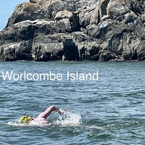
The swim: a non-stop, unassisted Marathon; first recorded circumnavigating clockwise around Pasley Island and the group of smaller islands around it starting at Ragged Island then Mickey, Worlcombe, Popham, little Popham, Hermit and Silver. Feding every 30min liquid and solid (jelly rolls). On a beutiful hot sunny clear day, with calm water and no wind. Gibson tie table indicated Low tie was 9.2ft at 07:46am, high will be 10.6ft at 11:41am, with a second low of 6.3ft at 17:52.
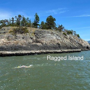
On Ragged Island we notice some crosses on the rocks witch we use as lanmark for the start of the swim, there was also a jumping platform and notice and eagle and some other birds around the area. Once Jessi was ready she jump in the water from starboard side, and made her way to stand in the rocks.
10:13 Jessi raise her hand to sign that she was ready, as she jumps and started the swim heading south a seal follow for a while.
~10:19 as the seal pop her head from a distance for the last time, we starting to encounter big patches of drift wood.
~11:00 Northwest winds and waves started to increase, witch made it difficult for the swimmer to progress as plan and for the boat to maintain a steady line and a starboard position from the swimmer, having to change to a Port side position for safety.
~12:50 As we clear Worlcombe and continue west towards Popham, conditions starting to improve for the swimmer making up time and even more once we started heading North. A lot less driftwood as well. From there on we had a few people approach showing appreciation and support for the achievement and effort so far. We also encounter more eagles on the way and a patch of jumping fish for a far.
Once we where beside Hermit island we could see Silver island ahead witch meant the finish line Ragged Island was just behind it. After that realization Jessi decided to skip the feeding and push it all the way to the end in order to keep the swim under 4 and a half hrs.
As soon as we got beside Silver island we could see the crosses on top of Ragged Island, it didn't take long to get to the finish line.
14:39 Jessi touches the rock at the finish line, completing the Marathon at 4:25:58 with a stroke rate between 65 and 70, winds between 0 and 7 knots , average air temperature of 29°C and 17°C in the water
Jessi takes a breather for a few second then swims to the boat to climb aboard through the stern ladder takes some of the grease off before getting dressed and we were quickly making our way back to Vancouver she didn't seem tired nor cold. We took a quick picture before returning to the dock, and say our goodbyes.
Pilot Debrief
Swimmer Narrative
by Jessi Harewicz
We met Frank outside the Jericho pier just after 8:30 AM. Loaded up quickly and started off towards Ragged Island. Our starting point for the swim. As we cruised towards Ragged islands we passed it and ended up near Hermit Island but proceeded back to Ragged Island to start. The plan was Clockwise swim starting at Ragged island to Worlcomb Island to Hermit Island back to Ragged Island.
We did the briefing and then I jumped in the water around a rock out crop with two different crosses. We didn’t know if it was a curse or a blessing to have two crosses for the start and finish point during the swim LOL a few bad jokes were made and then we got on with it. Started out pretty good. Water was pretty warm. Sun was hot, perfect conditions for a bit of bad wind. After the first hour I started getting a little bit nervous as the wind picked up. I knew this was gonna be the hard part. Matt jumped in to support swim. And as we got to 1.5 hours I started to get more concerned. We were on the first side of a triangle shape. We hadn’t even finished 1/3 of the swim and we were already at almost 2 hours. My dad had already said that once we got around Worlcomb Island, it would get easier. Matt was back ok the boat, I told home to call Don to confirm that we were going through the roughest parts at that moment. 5 minutes later, he confirmed this.
Just after two hour mark we finally turned the corner at Worlcomb Island. There is a man with his dog on a bunch of rocks. He had beige shorts on. I saw him watching for a while. Apparently cheering me on through the tough current on the corner.
We are headed for Popham Island. Getting this stretch done in about an hour! We turn the corner and headed towards Hermit Island. Matt asked if it was OK if he jumped in the water. I said of course ! So we swim for a bit again. Sometime within this I saw another small motor boats on the inside of us 50m away. Coming from the northern end Pasley island. I recognized this area as I had swam a few times in this part. I stopped quickly to tell my dad that if I could get it under 4 hours 20 minutes to not feed me on hour 4. My stomach reminding me about the feeding on hour 4 but I just push through. And was hopeful that I would get it under 4 1/2 hours now. Return the final corner and I saw the crosses. And this little diving board. Trying to remember where I started from. I passed the spot when they finally honk the horn ! Another frustrating swim done !
Photos
Video
Bowyer

Inspiration
Lhákw’tich meaning ‘it’s all rock bluff’. Abundant in wildlife like deer.
Ch’ich’iyuy Elxwikn/Lions Bay. Are the Twin Sisters bay. These mountains remain sacred for their legal marker of a peace treaty, family lineage histories, and spiritual value. The two peaks were transformed by the Sky Brothers, or Transformers, after twin sisters that had married with Haida twins created the path for the war to end between the Squamish and Haida people. The families that made the Peace Treaty and married together still live in the Squamish and Haida Nations. In another version of the myth, the Haida (Stek[’]{dir=”rtl”}in in Squamish), the mortal enemies of the Squamish, travelled down the coast to raid and enslave the Squamish. Among the Haida raiders were young twin brothers who were the son of a Haida chief. The brothers were given the task of guarding the canoes while the elder raiders scouted out the target village. The Haida boys grew restless and climbed up a ridge to view the Squamish village themselves. At sunrise they were surprised to see that the first Squamish villagers up were twin sisters. The Haida raided, killing many Squamish. The twin sisters were spared and given over to the brothers as wives, who returned to the north with them. Among the Haida the Squamish wives were admired but sad. They persuaded their new Haida family to seek peace with the Squamish, which the Squamish accepted. The Creator commemorated their peacekeeping by making them into immortal mountains. (Wikipedia)
Planning
Lhákw’tich/Bowyer was originally scheduled for May 19 2021. Don Martin had to cancel the night before due to family health problems. We though about doing it after Chá7elkwnech/Gambier, but the water started warming up faster than expected. It would not be possible to add on swims after Chá7elkwnech/Gambier swim. I thought ahead. I got Gunnar Jonson to planned 2 swims at the end of summer, Lhákw’tich/Bowyer & Smelhmelhélch/Passage Island. For early October, once the water ‘cooled off’ down to below 13c. October 1 & 15 for 10km swims. In typical Salish Sea fashion, the water cooled off so fast! 5 weeks from 17c - 12c water. The air temp cooled off faster. I felt so guilty as the excitement built up. All my swimming buddies were freezing & I was in heaven! The shorten daylight hours would mean, I get to swim at night! Cold & dark my favourite type of swim. Looking back my English Channel adventure was looking ‘tropical’ as every day got colder.
Planning for Jessi Harewicz’s swim around Bowyer Island took into consideration:
- Preferred start and end at Lion’s Bay. Lion’s Bay has a small marina facility with docks that could be used to start and finish the swim.
- Tidal conditions. Bowyer Island is in Howe Sound, where tidal currents often exceed 1 knot. It was imperative to make the swim on a day and time when Jessi had the possibility of a favourable tidal current for as much of the swim as possible. The date and time chosen for the swim was selected to give Jessi a favourable ebb tide during the first part of the swim from Lion’s Bay to the south end of Bowyer Island and a favourable flood tide on the final part of the swim from the south end of Bowyer Island back to the finish at Lion’s Bay. This meant the swim was timed so that low tide would occur approximately when Jessi was expected to pass the south end of Bowyer Island. This also meant the strength of the tidal currents would be relatively small, since the entire swim would be done in the hours immediately before and after the turn of the tide.
- Weather. Autumn is a season of frequent wind storms in Howe Sound and the adjacent Georgia Strait. It was important to make the swim at a time when wind conditions were likely to be no more than 10 knots, with minimal wave heights. The final go-no-go decision was made only after we had good confidence in a forecast that called for light winds in the area of the swim.
Support Team:: Gunnar Johnson (pilot), Richard Harewicz (kayak), Christine Burns (observer, feeder).
Route
Counterclockwise loop around Bowyer Island from Lion’s Bay Marina. 10.1 km
Result
- Start: 2021-10-01 06:00:00
- Finish: 2021-10-01 09:50:55
- Elapsed: 3:50:55
GPS Map
Observer Log
Observer Report
by Christine Burns
Jessi and I boarded the boat at Horseshoe Bay West Mooring @ 4:30am. We reviewed the pre swim briefing notes on the way to the starting point.
We arrived at the starting point (Lion’s Bay) @ 5:55am . We dropped Jessi off on the dock. Jessi entered the water via the ladder and then started her swim. Swim start @ 06:00:00
Jessi started the swim on the left side of the boat. It was dark so Jessi was wearing a green glow stick attached to her goggle strap.
Jessi was getting some help from the current and she was moving quickly. There was no wind.
6:30 feed 1 liquid. There was a thermos mix up which led to Jessi being fed with cold water. She noticed! We told her her speed was good and to keep it up.
There was a retractable dog leash attached to the side of the boat - this was used to throw things to Jessi and easily retrieve them.
7:00 feed 1 liquid. Jessi noted that her fingers were feeling cold
At this point the sun was up and the glow stick was annoying Jessi so she asked to swap out her goggles. I threw her the spare pair attached to the dog leash, she threw the first pair onto the boat.
7:30 feed 1 liquid - Jessi asks if the water can be warmer “this is the minimum level of warm that is acceptable”
Jessi was quickly making her way down the west side of Bowyer Island - ahead of schedule
8:00 feed 1 liquid and part of a cookie - Jessi asked for something solid so I threw her part of a cookie
I lost the weights that were attached to the thermometer - I made an inappropriate comment that I lost my balls.
I boiled new hot water for the next feed.
8:30 feed 1 liquid and part of a cookie - Jessi noted the water was nice and warm
Gunner mentioned that the tide was moving with us now - still not helping as much as we would have liked. Jessi slowed down once we pass the South east end of Bowyer - her paced slowed a bit as she swam back towards Lion’s Bay.
8:42 - Jessi had a cramp but just kept on going.
9:00 feed 1 liquid - Jessi asked how much longer - Gunner indicated less than an hour
9:30 feed 1 liquid - Jessi asked how much longer - Gunner indicated less than half an hour
Jessi touches the dock in Lion’s Bay. Swim is complete.
Swim finish @ 09:50:55
Swimmer Narrative
by Jessi Harewicz
The swim was slightly different to my other Swims. This swim had previously been booked as my first swim this series for May 2021! My father had to go away on a trip to Montreal. So I recruited the lovely Christine Burns to help me with executing this swim. Which involves also helping drive both of us to the boat and driving us home after the swim. The swim was going to happen early in the morning as dictated by the tides.
I was slightly nervous as we knew the water was cooling continuously. And I’ve never done a dark start in water close to 10c water. Christine picked me up super early. And we preceded to horseshoe Bay. We found parking and walked out stuff down to the dock to meet Gunner who had stayed over night on his boat at Ch’axay/Horseshoe Bay. I came fully prepared with breakfast sandwiches and hot coffee!
We tried to keep things simple for the swim as we anticipated no more than four hours. We started boating out towards Ch’ich’iyuy Elxwikn/Lions Bay Marina. The start of the swim. I chose not to wear any Destine, just Vaseline. Before I knew it, it was time to start. Gunnar had put a few glow sticks on the boat. As we did have about one hour or so of dark before the sun rise. I dove off the boat into the dark water. And swim towards the dock. As it was right in line with the high tide line. I climbed up a ladder. And stood on the dock. & dove into the water to start. The water was cool but I was confident. Just swimming next to the boat, down towards Lhákw’tich/Bowyer. So peaceful. I mostly just focused on keeping my stroke rate high to stay warm. And we approached the island the sky started to lighten. With these big mountains it’s takes extra time for the light to hit the water.
As we turned the southern end of Lhákw’tich/Bowyer, and headed back towards Ch’ich’iyuy Elxwikn/Lions Bay. I could feel some current that I was fighting. With a tiny bit of sun on my back it was okay. I saw Christine and Gunner cheering for the last hour or so. So we knew it we were back & I climbed up on the dock. To finish.I quickly got changed and bundled up as we boated back to horseshoe Bay. It was great swim.
Photos
Video
Passage
Planning
Gunnar Jonsson planned the last 2 swims of this set. Initially Gunnar looking at a 10km route around passage island. As the classic Whytecliff park around Smelhmelhélch/Passage return is only 8km. The October 15th low tide is at 8am and high tide is at 3:30pm. We could do Smelhmelhélch/Passage Island, starting and finishing on Nexwlélexwem/Bowen Island, where you started and finished your Nexwlélexwem/Bowen Island swim. That would require a very early start to be at the south end of Smelhmelhélch/Passage Island at 8am.
But I wanted to do a more recognizable/accessible repeatable route. The point of this ‘project’ is to show others, what is possible in Atl’ka7tsem. I knew people like Debbie Collingwood. Few other ladies like Roberta Cenedese have been swimming around Whytecliff for 10+ years!
So I thought Ch’axay/Horseshoe Bay around Smelhmelhélch/Passage and return to Whytecliff is 10.2 km.
Unfortunately the late summer winds caused us to delay the last passage island with rain and up to 30 knots of wind in the Strait of Georgia. Suggested to postpone to October 22nd, as the tidal range might allow a swim from Whytecliff to Smelhmelhélch/Passage, twice around and then back to Whytecliff. There will be some adverse current but hopefully not too much. I personally was excited we waited to do this route.
Planning Notes - Gunnar Jonson
We chose to go clockwise around Smelhmelhélch/ Passage Island is because the south end of the island is the area most likely to be exposed to wind and waves and a clockwise rounding meant the waves and wind were from behind rather than in your face.
- Support Team: Gunnar Johnson (pilot), Richard Harewicz (kayak), Sue French (assistant), Elisabeth Owre (observer).
- Route definition: Clockwise loop + 2 CW full circumnavigations of Passage Island from Whytecliff Beach. 9.8 km
Result
- Start: 2021-10-22 09:54:06
- Finish: 2021-10-22 14:41:56
- Elapsed: 4:47:50
GPS Map
Observer Log
Observer Report
Swim Description: Non-Stop, Unassisted swim in Atl’ka7tsem/Howe Sound. Out and back from St’éxw’t’ekw’s/Whytecliff Park with double circumnavigation around Smelhmelhélch/ Passage Island.
Gunnar Johnson and Sue French brought the boat (Sirius) from Coal Harbour to K’itl’alsm/Fisherman’s Cove Fuel Marina in West Vancouver where Jessi, Richard and I boarded the boat at 9:15h. The pre-swim notes were reviewed on our way to the starting point at Whytecliff Park.
We arrived at the starting point at 9:40h. Jessi dove off the boat and swam to the beach.
The swim started at 9.54.06h.
Jessi started the swim on the right side of the boat. The current was not favorable, the wind force was 7 knots. She encountered some swells from the passing ferry.
She had to adjust her earplugs just before her first feed.
Feeds: 1 hot liquid (250ml water and GU gel) and one jelly and peanut butter roll. We continued this feed throughout the swim every 30 minutes. She did, however, lose one of the jelly rolls and we had to substitute with half a sandwich on her last feed at 13h58. She chose to skip the last feed scheduled for 14h28 as she wanted to focus on her finishing since she was approx. 45 min behind schedule.
Temperature: The water temperature and air temperature were measured every 30 minutes. The water temperature was fairly consistent between 10.6 and 10.8 C. The air temperature varied between 12.8 and 11.5.
Weather and Wind: Overcast with rain. The wind force increased from 7 knots to 13 and then calmed down to 2 knots towards the end. Wind direction was S to S/E. Some whitecaps.
Current: The current was against Jessi on the way to Smelhmelhélch/ Passage Island
(1.4knots).The boat was pushed around slightly during some of the first feeds. The current was
favorable on the way back and allowed Jessi to catch up on some of the lost time.
Strokes: Jessi had a consistent stroke throughout the swim. For the most part 67/min with the exception of 68/min and 69/min between 11:19 h and 11:41h.
General: Jessi looked strong during the whole swim. She had to adjust her goggles and earplugs a few times. She encountered some leg cramping and shoulder pains (she had had some shoulder issues previously). There were no major issues except for avoiding swimming into flotsam and being too far from the boat during the first circumnavigation of Smelhmelhélch/ Passage Island.
The boat had to steer away from shallow water on the SW end of the island and Jessi was directed to swim closer to the shore. She did not like being so far away from the boat (20 m approx.), and this was rectified during the second circumnavigation.
She encountered a colony of harmless seals at the south end of the island.
The swim back to St’éx[w]{.underline}’t’e[k]{.underline}w’s/ Whytecliff Park was uneventful. She rested a short while on the beach before swimming back to the boat.
Swim finish at 14.41.46h.
Jessi was in good form and recovered from the swim within 30 minutes.
Swimmer Narrative
None submitted.


